Where is Aït Benhaddou?
Aït Benhaddou is in Near Ouarzazate, Morocco, in Africa. The game uses the reference point shown below: 31.0470°, -7.1297°. A guess within 25 km earns the full distance score before any hint deduction.
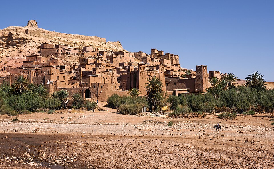
The marker represents the historic ksar beside the Ounila Valley near Ouarzazate, not the modern village across the river.
Map loading. Coordinates: 31.0470°, -7.1297°.
The story behind the landmark
UNESCO describes Aït Benhaddou as a ksar: a group of dwellings enclosed within defensive walls. The surviving buildings mainly illustrate construction traditions from the seventeenth century onward. The settlement stood on a commercial route linking regions south of the Sahara with Marrakesh through the valleys and passes of southern Morocco.
The Moroccan National Tourist Office highlights the way the buildings climb toward a granary on the hilltop. Housing, storage and shared spaces fit together within the settlement. Reading this arrangement helps distinguish the place from a palace complex: its striking appearance comes from a community built as a closely grouped whole.
How to recognise it
- Reddish earthen buildings clustered on a hillside
- Square defensive towers with geometric decoration near their tops
- A compact walled settlement rising toward a small hilltop structure
Look twice: a useful comparison
Other southern Moroccan kasbahs use similar reddish earth and square towers. At Aït Benhaddou, look for the whole hillside village and its ascending layers. A cropped tower is a weak location clue; the full composition of buildings, valley and hill is more distinctive.
A detail worth remembering
A ksar is a settlement, whereas the word kasbah often describes a fortified stronghold. Aït Benhaddou makes the distinction visible: houses, communal spaces and storage buildings share a protected enclosure instead of forming just one ruler's residence.