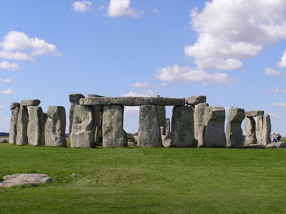
Where is Stonehenge?
Stonehenge is in Near Amesbury, United Kingdom, in Europe. The game uses the reference point shown below: 51.1789°, -1.8262°. A guess within 25 km earns the full distance score before any hint deduction.
The pin marks the main stone circle near Amesbury, not the larger surrounding prehistoric landscape.
Map loading. Coordinates: 51.1789°, -1.8262°.
The story behind the landmark
The first major enclosure was made around 3000 BCE. Large sarsen stones were raised around 2500 BCE, and the site continued to be altered over many generations. The surviving arrangement is therefore one stage in a long development that extended from the Neolithic into the Bronze Age.
The stones were aligned with the sun at the solstices. This supports an interpretation connected with ceremonies and the calendar, but the monument’s exact uses are not fully known. Archaeological evidence should be distinguished from later legends: the prehistoric builders did not leave a written account explaining every part of the structure.
How to recognise it
- Massive upright stones are capped by flat horizontal lintels.
- Curved groups of stones surround taller paired uprights.
- The monument stands in open grassland without a roof or enclosing building.
Look twice: a useful comparison
A ring of standing stones is not necessarily Stonehenge. Look for its lintel-topped uprights and larger paired stones. A tight crop can hide the circular arrangement, so inspect whether the visible crosspiece is deliberately fitted across supporting stones before narrowing the location.
A detail worth remembering
The solstice alignment is visible in the monument’s arrangement, even though its full purpose remains uncertain. Remember the distinction: a measured relationship with the sun is evidence; a detailed claim about every ceremony held here would go beyond what the archaeology can tell us.